
There Is A River
“I remember when we canoed the Pelly River in our handmade birchbark canoe, back in 2001,” Natasha reminisced as she looked across…
 The Yukon’s Campbell Region includes Faro and Ross River with a combined population of only 700 people.
In the beautiful Campbell Region of The Yukon, you can see animals in their natural habitats and visit a famous mine site. There are more photos to take here than will fit on your phone.
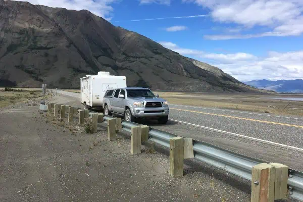
The goes through a part of the Yukon that is hardly populated and barely developed. There is a chance that you won’t see another car for a while, and likely won’t have to share the rest stops. Pack a lunch, or anything else you might need for all of the 3 highways into the towns. The journey is 361km on the Robert Campbell Highway from Watson Lake to Ross River, or 232km in from Carmacks. You could also take the South Canol 217km in from Johnson Crossing.
There are many chances to stop and read an interesting sign or take a walk along the lake’s edge. Keep an eye out for local plants and animals, but do so in a responsible way and keep your distance.
“I remember when we canoed the Pelly River in our handmade birchbark canoe, back in 2001,” Natasha reminisced as she looked across…

Weather, nature and life in the wild (mosquitoes included) continues to carry on, untouched by COVID.
It’s a small world – Part 2 Read More »

While tourists worry about bears in the Yukon, I worry about the excess of mosquitoes we’ve had this summer. I am prone to bad bug bites.
It’s a small world – Part 1 Read More »

There was a not-so-urban myth out there that you could see the Tintina Trench from the moon. That is not true, unless the person on the moon had a good telescope.
The Tintina Trench Read More »

Owen Laukkanen is unabashedly a writer of commercial fiction, also known as “genre” fiction, having produced a novel every year since The Professionals came out (and was nominated for four major genre awards) in 2012.
Owen Laukkanen: “Keep writing and edit your own work ruthlessly” Read More »

PHOTO: Dan Davidson The Yukon Writers’ Festival takes place May 2 through 5, with events throughout the Yukon In 1990, a number of organizations
Gearing up to explore ideas and the written word Read More »

Sitting at Watson Lake you may wonder if you should take Robert Campbell #4 to the Klondike, afterall, it is shorter. The answer is NO!
The Yukon’s Magnificent 11 – Part 3 of 6 Read More »
Summer, with its long daylight hours, is a great time to travel around the Yukon. But you need to pay more attention to gusts of wind…
The Yukon is Great for Summer Travelling Read More »
The Yukon Imagination Library — non-profit organization that gives free books to Yukon children from birth to age four — is turning 10 this year.
There’s Always a Stack of Books Hidden Under Their Quilts Read More »

For the first Faro Golf Tournament “we drew circles on the soccer field to serve as holes,” The Faro Golf Club incorporated in 2001.
Tee Time in the Town of Faro, Yukon Read More »
“They’re [cranes] a much more delicate bird, compared to the swans,” says Carrie McClelland, a wildlife viewing biologist with Environment Yukon. “They stand three and
By 2001, however, that big detached deck on the front of the house was deteriorating and we decided that a verandah running across the entire
The Evolution of a Home Read More »
Sometimes it seems like maybe they might not come. Then you hear them: the faint, high-pitched croaking, growing louder and louder. Then the sky fills
Nothing, Nothing, Nothing… Then Honks Galore! Read More »

I call Faro the Pleasantville of the Yukon. Unusual thermals (cranes swirl miles above town) & rock formations to make geologists drool.
The thermals above the town of Faro may account for the “tens of thousands” of sand hill cranes that fly above it each spring. Or
Cranes Fly High Up in the Sky Read More »
Robert Service School (RSS) celebrated its 25th year in its present building last May. There were no special celebrations, and I suspect that not too
Reflections on Rural Yukon Education Read More »
When Morgan MacDonald closes his classroom door a few weeks from now, he’ll hit the road-less-travelled to gauge how far an alternate career path might
You know a painting is really good when you can lose yourself in it. Just like looking at a fire; you get hypnotized. Faro artist

I lived 20 years in Faro. I could tell of a golf course started with spray-painted targets, hiking Van Gorda Falls, cabins on the Dena Cho.
Getting Around the Yukon: Faro Read More »

Faro’s Crane and Sheep Viewing Festival has attracted international attention before as it grows yet again in its fifth year.
Faro’s sheep and cranes ready for their closeup Read More »

Faro turns 40 on July 1. When you’re a mining town with no mine, every anniversary is special. But this one is more so.
Faro fetes its 40th Read More »
When the world thinks of Canada, they think of the Yukon. When Yukoners think of the Yukon, they think of Faro. When the world is
Happy Anniversary, Faro! Read More »
Trevor Twardocleb’s eyes light up when he recounts his own first experience at the Arctic Winter Games. It was 1980 in Fairbanks, Alaska. Twardeochleb, then
The Best Job in the World Read More »
Would-be rockers in Haines Junction and Faro have a chance to perfect their performance chops in the next few weeks, with help from rock trio
Young laughter rings out in the Faro Kettle coffee shop in the Recreation Centre, as the community celebrates the unveiling of a new mural that
A Wall of Colour Tells a Tale of Faro Read More »
A quarter million sandhill cranes! When, anywhere in this territory, do we have the opportunity to see a quarter million anything? Caribou? Nope. People? Not
Sandhills on Demand Read More »
In the quarter century since the late Rob Harvey founded Yukon Engineering Services (YES), the company has had its hand in the majority of mining
t can happen to anyone. You forget to set the alarm, you sleep in, you miss an important flight. But when you’re a migratory bird,
Faro-based artist Jackie Irvine set herself a challenge. What if she painted one painting a day for 100 days? Starting October 1, 2011 she did
100 Steps Further In Read More »