Allison Bay on Atlin Lake is one of many spectacular views
Of all the cities, towns and villages in northwestern Canada, Atlin’s journey through the turbulent 20th century was more dramatic than most. It went from a golden boom town, in 1898, to a burnt-down town in 1901, then another boom until the fire of 1914, which destroyed the downtown core a second time, followed by a tourist boom that lasted from 1917 into the 1930s Depression, before WWII and the end of the White Pass excursion boats, which almost made it a ghost town before the road was built, from 1949–51, which secured a future but not a prosperous one.
At one time, for all the length of the Roaring Twenties of the Great Gatsby era, Atlin was a premier domestic travel destination for the wealthy, who were denied their usual jaunts and haunts in war-ravaged Europe. The 1914 fire, which wiped out the downtown area, led to the construction of the grand three-storey Atlin Inn, which opened in 1917, the same year the Tarahne was built and a year after White Pass began stopping at Ben-My-Chree on Tagish Lake.
A 2.25-mile narrow-gauge railway, the Taku Tram, built in 1900 at the end of Graham Inlet, hauled visitors to Scotia Bay, on the west side of Atlin Lake, and the tourist boom was underway. It slowed down dramatically during the Depression, and the Tarahne was beached in 1936 but didn’t completely shut down until the Atlin road was built and the start of RV visits that continue to this day.
Although a February, 1949 editorial in the Whitehorse Star accused the various governments (B.C., Yukon and Ottawa) of “inanition” (death by starvation), for not building a road into Atlin, the community was never actually isolated and cut off from the outside world completely. In the years between the world wars, during her tourism heyday, Atlin was connected in summers by the lake boats, and in winters by the Fantail Trail:
“In 1898 the White Pass and Yukon Route built the Fantail Trail from Log Cabin to Atlin. The 45-mile/70-km sled trail was used for many years. Passengers and freight travelled on horse-drawn sleighs, while dog teams carried the mail.
“One enterprising butcher even drove cattle over the trail in the late spring. The Fantail Trail was only used in the winter; in the summer, passengers and freight travelled to Atlin on lake steamers,” as explained by a sign at Log Cabin where the Skagway Road crosses the railroad, near the Fantail starting point. The name comes from Fantail Lake, an east/west finger-like waterway covering about half the distance from Log Cabin to Atlin.
(Note: The sign is in error: Tarahne was not a “steamer.” It was powered by twin six-cylinder Wisconsin gas engines with a top speed of 12 knots.)

The road from Atlin to Tagish Junction, near Jake’s Corner on the Alaska Highway, was built from 1949 to 1951, but the Tarahne was mothballed in 1936 and the Atlin Inn was boarded up. The high point was 1928, when 9,627 visitors came across the lake from Scotia Bay; and 1929, with 9,094 customers. Black Friday, the Depression and WWII killed Atlin tourism but also saved it with the Alcan construction in 1942–43.
There is no question the road gave Atlin a future and at least a chance to join the second half of the 20th century. Without it, Atlin would surely have gone the way of all the other boom-and-bust mining towns in the North.
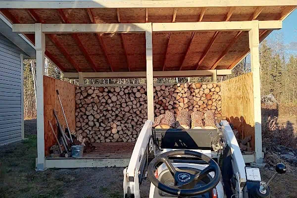
Nowadays, the area has plenty of beautiful, peaceful places to RV camp, from the ballfield park in town, to Surprise Lake, Pine Creek and Warm Bay, a short distance downlake from the townsite.
“The Switzerland of the North” moniker was simply an overused and inaccurate White Pass advertising slogan that was also used in other mountain towns like Ouray, Colorado, which calls itself “The Switzerland of America.” As one who spent several winters all over Switzerland, writing ski racing stories, the mountains around Atlin bear little or no resemblance to the Swiss Alps; nor is it “the most beautiful place on Earth” as claimed by Discover Atlin’s website, but it is the largest natural body of water in B.C. and one of the more beautiful places in a big, beautiful province.
Although it’s a difficult thing to explain to touring visitors, Atlin is as much a feeling or sensation as it is a photo op. The place just has an enduring aura about it, and a quiet charisma you won’t find anywhere else. Maybe it has something to do with the “Boom, Burn, Bust, Boom” history, or maybe it’s just a mysterious place by geographical definition. On a map, Atlin and the long-abandoned Ben-My-Chree (Manx for “Girl of My Dreams”), the two tourism stars of the 1920s look like provincial orphans that tried to run away to the Yukon or Alaska, but never got there.
Atlin is a must-see RV destination in northern Canada, but one that is bypassed by too many visitors because of the “dead end” angle. You can’t pass through Atlin accidently on your way to the Klondike, although many stampeders did just that in 1898. You have to want to go there and, if you do, you won’t regret it.
In many ways, Atlin today presents a more realistic portrait of an old gold-rush town than even Dawson City, despite the fires. Modern Dawson resembles a retired madam, covered in makeup and lipstick, trying to relive her glorious and prosperous youth. Atlin is more like a frisky cancan dancer who aged gracefully without losing her beauty, dignity or charm.
But that could just be one old writer’s jaded opinion. Check it out and come up with your own.
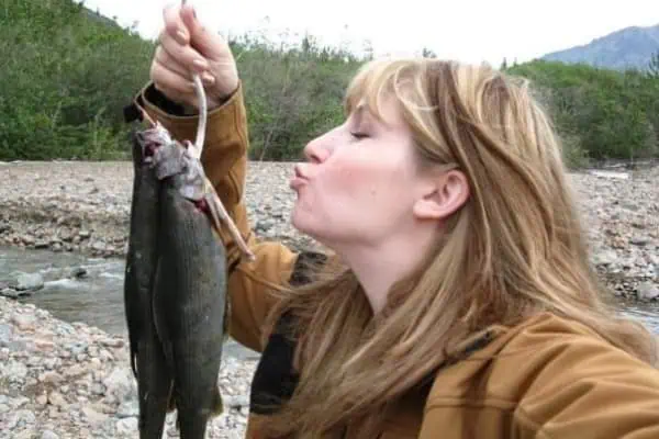
And, oh yeah, there are still big fish in B.C.’s biggest natural lake—lots of them. Try the north end at a depth of 50′ near the mouths of feeder streams.