I never understood how people love to go camping at the same spot year after year, or walk the same trail over and over, canoe the same river, or go to the same mall. I realize now that we all have different goals.
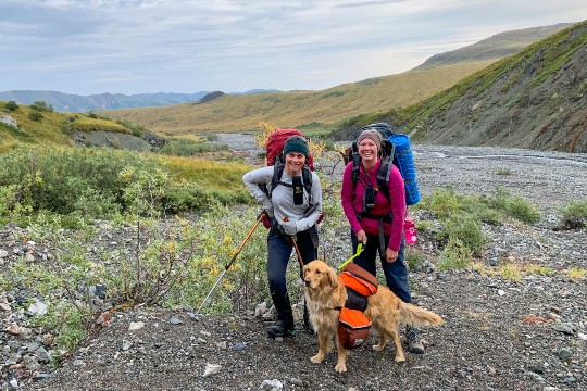
I myself have a strong desire to explore. And finally, I am starting to understand that even this can be done at the same spot. After all, I have been living in the same place for nearly 25 years. Having pretty well exhausted all the different trails around here, I have had to learn that no trail is always the same.
I will be Stony Creek Trail for the third time this year.
Going up the same old way, (starting at the Stony Creek gravel pit along the Alaska Highway, around 58 km northwest of Whitehorse. The trail is on the east side of the gravel pit and works it’s way up the bank. Make sure you know where you are going beforehand as the trail is not marked.) I brought a mining claim map with me. Stony Creek has always had a small mining operation, but in recent years there has been a flurry of claim staking.
The claims are laid out in an orderly grid pattern. In the Yukon, posts still need to physically mark the claim area, and from post to post there are still cutlines where the trees need to be cleared.
Today, I plan on following one of those cutlines to come out by the creek on higher ground, where the existing trail has long veered away from the creek.
Soon, it becomes apparent how important it is to know the area when venturing off the beaten track. I find a cutline fast enough, but If you have done any wandering in the wilderness, you might know how easy it is to get disorientated. In 10 minutes (lucky only 10) I walked in a circle, coming out by the main trail a little ways back. The fact that it can happen so easily without realizing it is an important lesson on its own. Hiking in a group probably would have avoided this, as someone would have noticed. I give it another try, now making sure I keep my bearings.
All goes well, without having to use my compass (which I have as a back-up). I walk in a straight line from visible and distinguishable treetop to treetop, ending up at the treeline. As nature wills, the treeline is not as clearly defined as a cutline.
The forest just opens up slowly; the terrain becomes more open. However, the cutline either stops here or is not visibly marked anymore. I decide to cut through to the creek from here and I can see the clay bank on the other side. Easier said than done. “Why is the forest always so thick around creeks and rivers?” I mutter to myself. I do my research later, sitting on my sunny porch.
Apparently streamside vegetation, as it can be called, drops food and nutrients into streams for fish. (There are no fish in Stony Creek that I know of). Tree roots and shrubs along the banks provide fish with hiding places away from predators and they moderate the water temperature during the hot summer months. Dense vegetation stabilizes stream banks and prevents excessive erosion. It also keeps the water clear by filtering rainwater runoff and slowing flow from heavy rains. In addition, and the spongy soils soak up excess water and release it slowly. Most wildlife uses these streamside areas at some point in their life cycles. They also are used as wildlife corridors to move unseen from one area to another.
Yes, there could be bears, in such areas, and I keep alert and sing songs to warn them, letting them know that I’m only moving through. I find a moose trail that comes out by the creek and it soon becomes apparent that moose walk in the creek. I don’t plan to do that today. Instead, I enjoy sitting beside the rushing water on a particularly large boulder, which makes an opening in the thick bush.
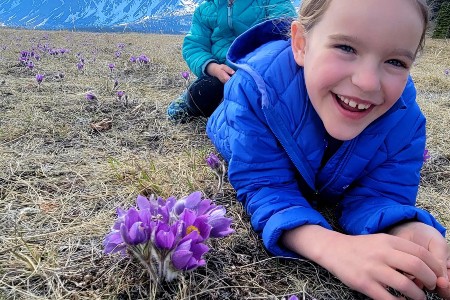
I continue up the creek, often coming to dead ends – rabbit holes, I call them – where I have no way to continue. Yet, somehow I always manage to continue, while finding some beautiful darkness-loving wildflowers in the moss along the way.
I have long wanted to see if there is an easy way to cross the creek for future hikes to go to the mountain on the opposite side, and now I look for one. There is not! The only way – that I already knew about – is the long way around, up and down or “sidehilling” three peaks, coming out above Stony Creek and going around it.
As soon as the bank steepens, I am faced with a vertical rock wall alongside the creek ahead and I turn away from the creek to head up the mountain slope, finding a relatively open gateway to higher ground. Huffing and puffing, due to the steep slope, I finally get above the treeline and discover not just a single flower here and there, but a whole carpet of sun loving flowers.
Again, knowing the area, I know to avoid a fold in the mountain full of scraggy willows that are about eight feet tall. Still, I go higher. First, to come out above the moraine that connects this mountain to the next: the one where I know the original trail ends. This is where I have lunch, out in the open, in a spot that offers me a view of the whole Takhini Valley and the mountain beyond. I can also see the location of the trail end, a point that I call basecamp. I feel at peace once I know exactly where I am.
The Stony Creek Trail, which at almost two meters wide is a well-defined trail, is actually notorious for getting lost on. But those are stories for another day.
Trails can give a false sense of security. Even when following a trail, I always make sure I know the area I am in, by way of maps and orientating myself before and during the trip.
I still hike without a GPS. I know a GPS can help a lot, but what if it fails to work? I always have a plan B, C or even D.
If you go east from the base camp on the Stony Creek hike there is an incredibly beautiful vertical rock face (visible from the Alaska highway). Someday, I would like to explore it some more. Just another day on the “same ol’ trail.”


