I am making my way up a mountain. I am alone, tired, and very thirsty. The nearest road or person is 30 km away. The sun has just disappeared behind a mountain; I know it will be dark shortly. I must make it back to my tent soon, or risk crossing a rushing creek in the dark. I have just fi nished climbing a section of very steep and crumbly rock. I can’t be certain, but I am fairly sure I almost died a moment ago. I am now on safe and less steep grassy terrain.
I know the summit must be close, and behind it, what I have come looking for. But I also know that hiking up a mountain involves many false summits, each one more frustrating and spirit-killing then the last.
How did I get myself into this situation?
The Ä’äy Chù (Slim’s River) West trail is a hike in Kluane National Park. Together with the hike up Observation Mountain, the entire route is 60 km round-trip. It is described as being “very difficult”, and it is recommended that you give yourself four to seven days to complete it. Some of the hazards along the way include bears, fast flowing creeks, and getting lost.
At the top of Observation Mountain there is a magnificent view of the Kaskawulsh Glacier.
This was what I have come for; I want to catch a glacier sighting.
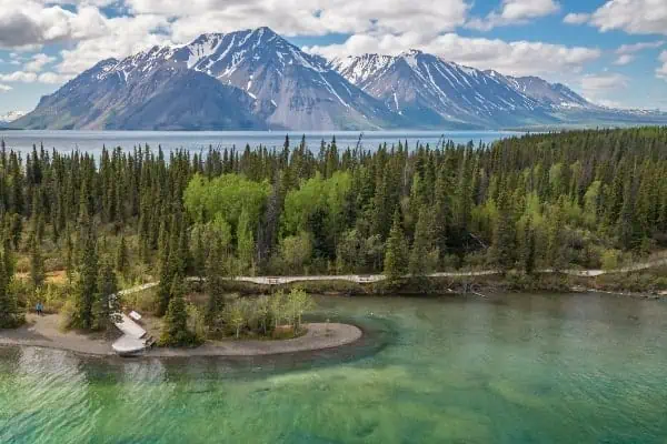
I had planned on doing the round-trip hike in two days. The first part of the hike wanders along an old road, first through trees and then down a hill that gives you a nice view of some of the St. Elias Mountains. You then cross Sheep Creek, then a marsh with a board walk. Next, there’s another creek crossing, a huge dry creek bed, and then some sand dunes. Who doesn’t love sand dunes? After that is a lot of marshy, muddy yuckiness, which you can sometimes avoid by finding a trail through the trees. Then there are some alluvial fans (rocks and boulders), some more trees, then more alluvial fans, and so on.
Along the way I look at the time, trying to decide if I should push for the summit on the first day, or camp after 22 km and push for the summit and return the next. “If I get to the campsite by 2:30 p.m., then I’ll push for it today,” I said when I started out.
Then, when that looked unlikely, I told myself: “3 p.m. But no later.”
When that looked unlikely it became 3:30, and so on.
Eventually I make my way up and over a hill, with the glacier’s endpoint in full view, before finally reaching the last campsite at 22.5 km.
I was tired. I sat down on a bench and looked at the time: 4:00 p.m.
I had only several hours to attempt 16 km, up a mountain and back down again, through another creek crossing, with no wellmarked trail. The smart thing would have been to set up tent, get a good sleep, and start early the next morning.
But I probably wouldn’t be writing this article if I made the smart choice.
I immediately set off for the summit. From this point there is no longer a well maintained trail, or any trail for that matter. Essentially the trail goes to the mountain over a huge mostly-dry creekbed and a final creek crossing. Once near the base, I picked up some cairns and followed them along the side of the creek. Eventually I found a trail that lead up the side of the mountain, and from t h e r e there is a choice to hike to the summit or head for the plateau in order to gain your view of Kaskawulsh.
I, on the other hand, in haste and stupidity, somehow missed a cairn and decided to head straight up the mountain following a boulder gulley.
Boulder-hopping eventually lead me to a steep rock section, that I could tell lead to a safer grassy section above. Going for this rock section was such a terrible idea in retrospect. I hadn’t seen anyone on the trail all day, and if I got hurt any rescue would be a day or two away. I did, at one point, realize how bad of an idea this section was, as the rock was continuously falling away, down the hill. This did not make for a happy sight, as the rocks would tumble and fall and pick up speed and crash into the boulder gulley below.
Unfortunately, by that point, climbing down seemed more dangerous than climbing up. The scariest moment came when, while pulling on a large rock above me, the rock began to give way. Had I continued to pull, the rock would have surely fallen onto me and sent me falling to my miserable doom.
By the time I reached the safety of the steep grassy section, I was exhausted mentally from the scare, dehydrated, running out of time, and I still had more hiking to do. One foot in front of the other I managed to climb hill after hill. “Where the hell is this summit?” I asked myself, again and again, in vain. Finally, I found a small pond at the bottom of a saddle between what I knew could only be false summits. I sat myself down, treated the water, and as I waited, I decided that I would climb onto the saddle, and that would be the last of it. Kaskawulsh or no, I had to get back in order to cross the creek and find my campsite.
Rehydrated and slightly refreshed, I picked myself up and made for the saddle. Well wouldn’t you know it, those summits weren’t false. As I peeked over to the other side of the mountain, my eyes were met with the most unbelievable sight: Kaskawulsh Glacier, in the icy flesh.
Black and blue and white and awesome. Its surface cracked and ragged, its body receding far away into the mountains. From here you can see deep into the St. Elias Range and the world’s largest nonpolar ice-field.
The glacier looks like a longexposure photo of a great polar bear stampede — massive tons of ice, flowing like a river stuck in time, but with the most incredible and destructive force. These are the things that carve entire landscapes, and break mountains. It fully rewards the effort to go and see it.
A sight like this can bring you to your knees.


