I’m not a miner, but on a recent visit to Germany my friends took me on impromptu mining tours of their regions.
First Clemens and I drove 100 kilometres west of Leipzig to Wangen and the Arc of Nebra (Arche Nebra) museum, where the Himmelsscheibe (Star Chart) of Nebra was discovered in 1999.
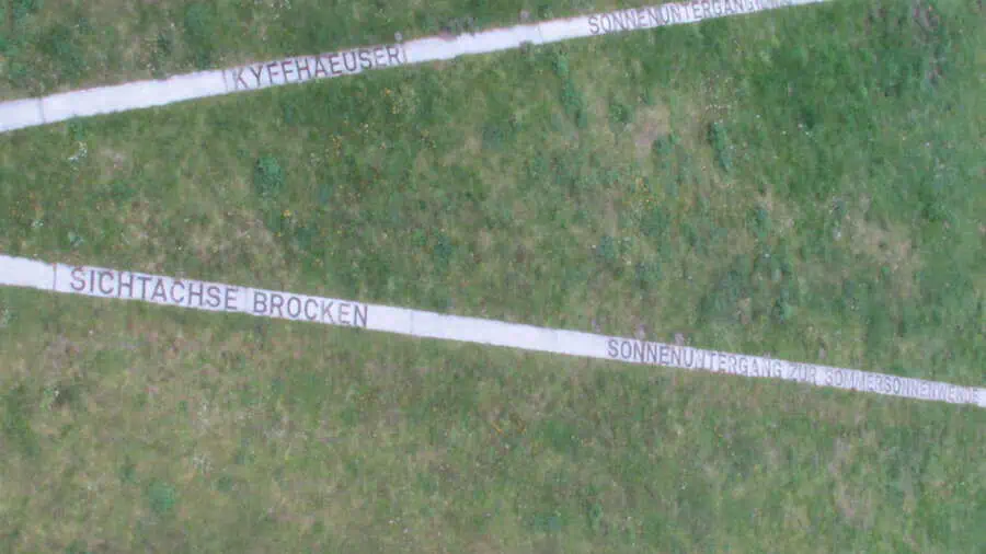
Dating back 3,600 years to the Bronze Age, the Star Chart is the world’s oldest concrete representation of the cosmos. Archeologists have determined that the Chart, when aligned with the prominent mountaintops of the Brocken in Harz and Kyffhäuser in Thüringen, confirms the position of the sun on May 1 – the start of planting.
The 32 centimetre disk is crafted from copper with a gold full moon (or sun, depending on interpretation), a crescent moon, and 32 gold stars, a number of which are grouped like the star cluster Pleiades. The only mythical symbol is a semi circle on the lower rim, interpreted as a sun boat or the “Arc” of Nebra.
The museum pays homage to our ancestors’ concept of the sky, and atop a tower at the site of the find three kilometres away, visitors learn how the Chart was used.
Of particular interest is the exhibit of artifacts from the early days of underground mining, telling the story of how our modern mining ancestors extracted the ore to create the Star Chart.
A miner, called Bergmann in German, would descend notched logs to reach the pocket of ore. One false step on this often two-hour climb, after a 10-hour shift, was easily fatal. It’s what led to the Bergmann’s greeting “Glück auf!” meaning “good luck climbing back out.”
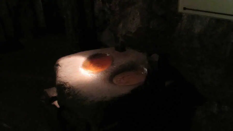
According to a display at the Nebra museum’s mining exhibit, a miner would cut the smoky gloom with a flaming toothpick, held between his teeth until the light burned out at his lips and was replaced.
Underground (Untertage in German, meaning “under-day”), the Bergmann chipped away at the ore with a short-handled wooden shovel that ended up as bent as he was.
Fast forward 500 years and 250 kilometres east to Altenberg, Sachsen, where in 1458 a caved-in drift from a tin mine from the middle ages was discovered. The St. Johannes Grube, which became the Grube Altenberg, or Altenberg tin mine, is where my friend Gunter worked until the operation ceased in 1991.
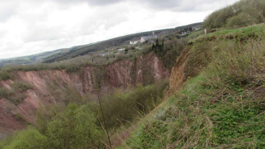
Altenberg’s ore came to the surface when “pulpit” mountains rose up as the surrounding landscape dropped in the previous ice age.
All this is explained in a museum maintained by an active miner’s association. They offer a tour of a shaft that describes the production of tin: from discovery, through the industrial revolution, to the peaceful revolution of 1989 that led to Germany’s reunification. Within a year, the bottom fell out of the tin market.
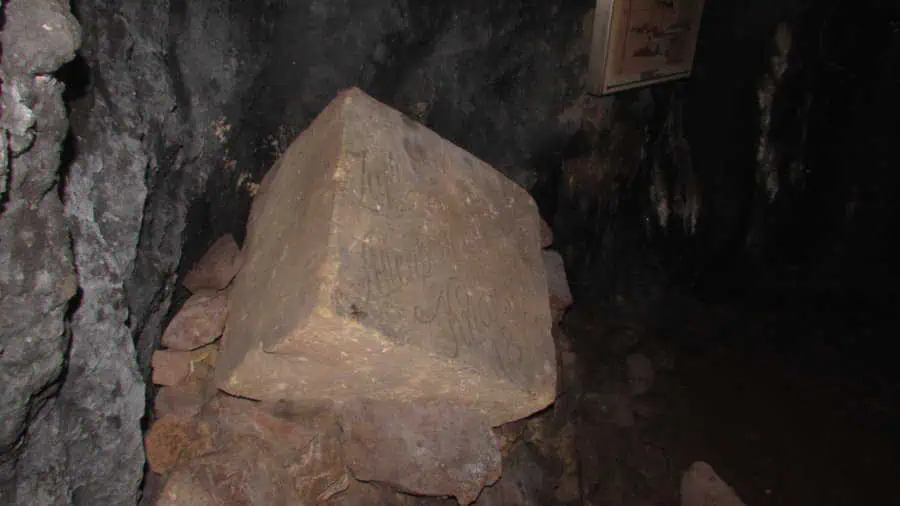
Similarities with underground operations in Keno and Faro abound, but what you’ll never find in the Yukon is a cornerstone carved to commemorate the refuge found in the shafts as villagers fled Napoleon’s army in the War of 1812-13.
At the third stop, in Wolfshagen, 380 kilometres northwest, I came full circle as I celebrated Walpurgisnacht, welcoming the May Queen, and the start of planting, on May 1, with cousins Edith and Reinhold.
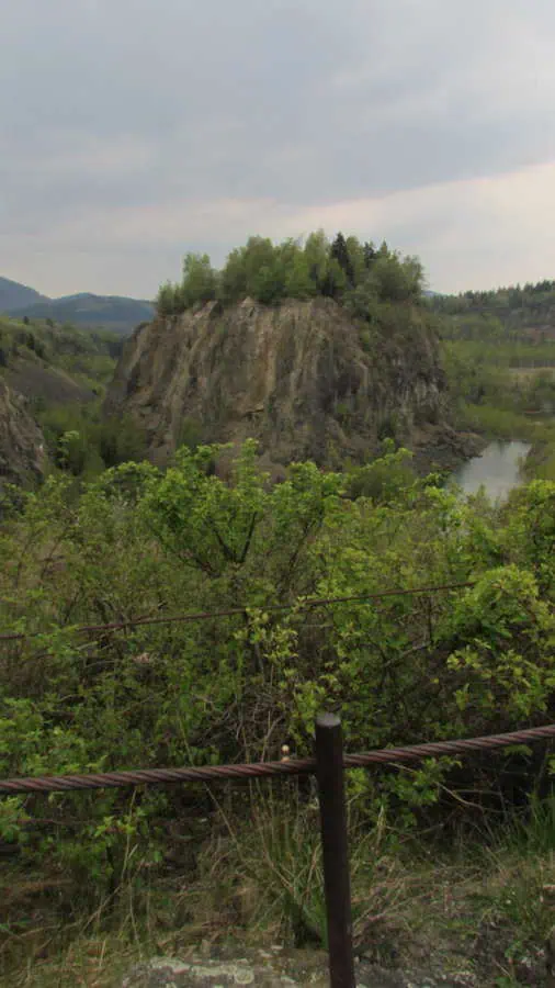
To recover from the celebration, we hiked the Spur der Steine. The trail leads to an untouched stone island in the centre of a defunct mine. Reinhold recalled the end of every day shift when the crew detonated their charges to loosen material for the gravel mill to process in the next shift, “Every day at 4 o’clock it used to explode here.” Once the main employer in the region, the operation closed in the 1990s and the gravel pit filled with water.
The legacy today is a stone island, known as the Heimberg on the Harzer Wanderweg regional hiking trails. It offers absolute protection to nesting sites of dozens of unique bird species that make their home only on the Heimberg.
Both Wolfshagen and Altenberg have become resort villages offering trails, camping, glamping, wellness and sport in place of industry. As a result there’s an appealing mix of hiking and history for a Yukoner in Germany.


