The making of a mine is a complex process. The discovery is just the beginning and sometimes the easiest. Each mine has its story; this one is about Brewery Creek. The earliest discoveries of mineral deposits happened when someone came across deposits that had worked their way to the surface. For all the obvious ones that were discovered in this way, many more were hidden just beneath the surface. Brewery Creek was one of those.
The Brewery Creek Mine is located 60 kilometres east of Dawson City, but this story starts east of there, in 1979. That’s when Rio Canex Exploration Ltd. staked the “IDA” claims in response to the results of a Geological Survey of Canada (GSC) stream sediment sampling program. There were a number of high arsenic, antimony and mercury values in the area. These elements are commonly associated with gold deposits. Rio Canex spent three summers exploring the property. The company found some high gold values, but numbers were sporadic. Rio Canex did no further work and the claims eventually lapsed.
A few years later, on a dark February day in a windowless office of Noranda Exploration Company Limited in Whitehorse, Craig Hart was researching publications. The previous work on the IDA claims caught his eye. Since the Rio Canex claims had lapsed, he suggested going out there in the summer to “poke around.” Soon after, Hart left Noranda to pursue work that ultimately led to his PhD at the University of British Columbia and a distinguished career in geology.
Noranda, meanwhile, went to the property early that summer and took some samples. The property looked like it had enough potential to stake claims and conduct further work. There was good scientific data for the area, thanks to the GSC and the Yukon Exploration and Geological Division of the then-Department of Indian and Northern Affairs. Lewis Green of the GSC had published his geology memoir in 1972. There were also GSC regional stream sediment and airborne magnetometer surveys for the Klondike area.
Green’s map showed small pods of 80-million to 100-million-year-old intrusive rocks coming up through much older sedimentary rocks. The rocks are known as syenite, similar to the rocks that form the steep jagged mountains in Tombstone Territorial Park. At the IDA, only the very tops of the syenite were exposed. Intrusive rocks are much more magnetic than sedimentary rocks. The GSC magnetometer survey showed a dome-shaped high beneath the claims, indicating more syenite below surface.
As mountains erode over millions of years, particles of the rock eventually work their way into creeks and streams. Sampling of the fine sediments in water courses can give you an idea of what is upstream. The GSC stream sediment survey not only showed high arsenic, antimony and mercury around IDA, but it also suggested two other areas shared the same three characteristics. They were to the west, lower in elevation with little exposed rock. Noranda decided to have a look at these as well.
The westernmost area of interest was 25 kilometres northeast of the Dempster Corner. The science pinned it down to an eight-by-eight kilometre target. Gord Mackay and Murel Trudzik flew out by helicopter looking for an area to land and set up camp. It’s usually best to find a site with a nearby water source. Due to dense trees and bush, this was not possible for the pair. They filled jugs of water in the South Klondike River, enough for a couple of days, then flew up to the only landing spot in the target area (a small, bare ridgetop) and pitched their tent.
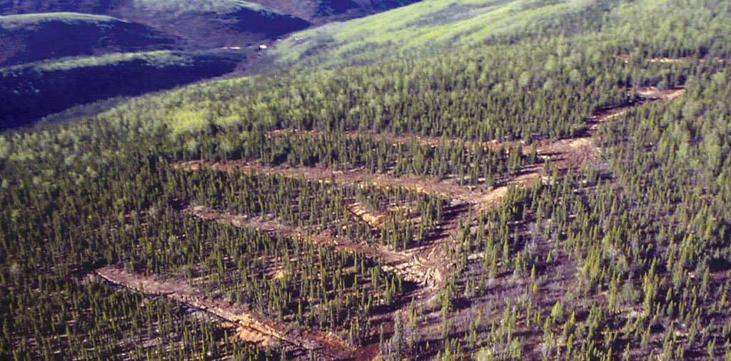
As there was no rock outcrop at the surface, Mackay and Trudzik took soil samples. Soil is decomposed rock. It carries the same chemical signature, especially in unglaciated areas such as the Klondike. The pair spent two days taking dozens of samples at regular distances along all the ridges. When the results came back, weeks later, there were high values of arsenic, antimony, mercury and gold, stretching hundreds of metres. They had unknowingly camped near the centre of what eventually became the mine. The first 32 claims were staked in October 1987.
In 1988, extensive soil sampling and hand trenching, resulted in more claim staking. The trenching was able to expose the rock that contained high gold values. This confirmed the source of the gold. Further exploration would require drilling, geophysics and a bigger budget. Noranda Exploration had offices all across the country. Projects competed for money at budget meetings in January. Each office presented its best projects and company management dealt out funds to the brightest prospects. Noranda knew it had a good project, but needed something to give it an edge. Inspiration came from Noranda’s western regional manager, Phillip, a highly experienced geologist who loved his beer and was in the sunset of his career. Phillip’s typical lunch consisted of five Labatt Blues and several cigarettes (afternoon was the best time to ask for favours from Phillip).
The discovery was located at the headwaters of Laura Creek. A few kilometres to the east was Brewery Creek, shown on some maps as O’Brien Creek. Thomas O’Brien founded the O’Brien Brewing and Malting Company in Dawson in 1904. It was the edge Noranda needed. The project was named after the nearby creek. The different gold-rich zones were then named for beers, starting with the Blue and Coors zone. The company president, who attended the budget meetings, had a fondness for Coors Light.
At the budget meeting, the stars aligned. Noranda’s presentation on the property happened to take place right after lunch. All went well and Brewery Creek quickly hit the company’s top 20 list. As encouraging results continued, more zones were discovered, including Kokanee, Golden, Pacific, Sleeman, Classic, Bohemian, Schooner, Foster’s, Canadian, Big Rock, Lucky and Moosehead. The names reflected the regional tastes of the many people working on the project.
Noranda was a large international mining company that needed mines big enough to sustain itself. In those times, a property needed to be able to produce 1,000,000 ounces (31,000 kilograms) of gold to be worthwhile for Noranda to see it through to production. After two years of intensive exploration, it did not look like Brewery Creek would reach that target. Noranda started looking for a partner to share the risk. In 1990 a deal was reached with Loki Gold Corporation. Loki could get a 49 per cent interest in the property by funding the next two years of exploration.
In those years, exploration, environmental and metallurgical studies were carried out at Brewery Creek. In 1993 Loki bought the entire property from Noranda. The following year, work began on permitting the mine and obtaining financing. The partnership also commenced economic development negotiations with the Government of Yukon and the Tr’ondëk Hwëch’in First Nation.
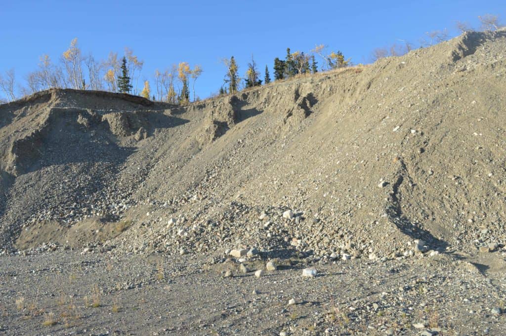
Eventually, in 1996, Loki merged with Baja Gold Inc. and Viceroy Resources Corp. The new company, under Viceroy’s name, started commercial production in May 1997 from the Golden and Kokanee zones. Five years later, low gold prices forced the cessation of mining and the start of reclamation. In total, the mine produced 270,000 ounces (nine tonnes) of gold. That is about 700 gold bricks of the size you commonly see in the movies.
Golden Predator Mining Corp. currently owns the property, having optioned it from Viceroy in 2009. The company continues to explore, find more gold and wait for the right economic conditions to begin mining again.
The making of any mine is a combination of teamwork, science, luck, partnerships, cooperation and, sometimes, branding.