Klondike Highway (#2) and Silver Trail Highway (#11)
From a comfortable, 21st century perch, the casual Yukon visitor might mistakenly assume The Klondike Highway (Highway 2) was planned to be a Skagway to Dawson tourist route, roughly following the journey made by the stampeders in 1898, but nothing could be further from the truth.
It was never a Point A to Point B highway – more like a giant game of connect-the-dots.
The Magnificent 11 The Yukon’s Highways
Hwy 1 – Alaska Highway
Hwy 2 – Klondike Highway
Hwy 3 – Haines Road
Hwy 4 – Robert Campbell Highway
Hwy 5 – Dempster Highway
Hwy 6 – Canol Road
Hwy 7 – Atlin Road
Hwy 8 – Tagish Road
Hwy 9 – Top of the World Highway
Hwy 10 – Nahanni Range Road
Hwy 11 – Silver Trail Highway
A map to this series
Part 1: Introduction and Canol Road (Hwy 6)
Part 2: Klondike Highway (Hwy 2) and Silver Trail (Hwy 11)
Part 3: Campbell Highway (Hwy 4) and Nahanni Range (Hwy 10)
Part 4: Atlin Road (Hwy 7) and Tagish Road (Hwy 8)
Part 5: The Dempster (Hwy 5) and Top of the World (Hwy 9)
Part 6: Haines Road (Hwy 3) and Alaska Highway (Hwy 1)
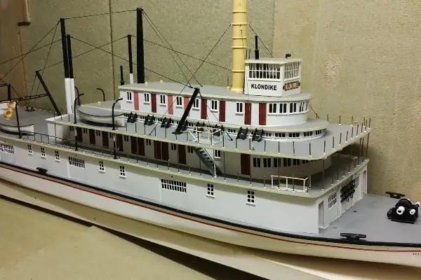
The Whitehorse-Tagish-Carcross loop of Highway 2 was actually part of the Alcan (Alaska Highway) construction in 1942, the meat of the road from Whitehorse to Mayo began in 1947 with the post-war revival of the old Treadwell Mine on Galena Hill near Keno City eventually putting the Sternwheelers out of business by 1955 – which was also when the Stewart Crossing to Dawson section opened.
But it wasn’t until 1978 that the last stretch between Carcross and Skagway was finished and opened in 1979 that you could actually drive from tidewater at Skagway to the goldfields of the Klondike.
None of the construction was done for tourism reasons. It was all about wartime emergency and routine mining access, yet today it is known as “The Money Road” to tourism businesses and workers because of the huge number of worldwide tourists who disembark in Skagway and scatter all over the North, particularly Dawson and Alaska, to distribute their wealth into the northern hinterlands.
The toughest part of the entire 705 km uncoordinated project was the first 39 km (24 miles) out of Skagway, which was begun in 1950 on the side of a mountain and abandoned until the mid-1970s.Through most all of the 1950s, there was road access from Whitehorse to the silverfields and goldfields across the territory, crossing the Yukon, Stewart and Pelly Rivers via ice bridges in the winters and ferries in the summers until the three large bridges were completed and painted by 1960.
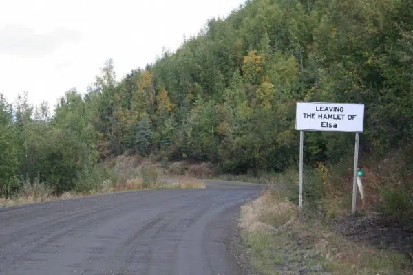
United Keno Hill Mines at Elsa quadrupled their ore production, thus income, when the road and bridges were opened and they could move their product by land rather than seasonal water.
The slow sternwheelers caused a huge logjam of ore bags at Mayo Landing waiting for shipment to smelters in Montana, which cost the mining companies a fortune until the Yukon finally modernized and joined the 20th century by building the road.However, to look at the volume of tourist traffic today, when only one mine is operating, you would think it was all planned as a tourism project. But it wasn’t.
Photos: courtesy of Government of Yukon
The Silver Trail (Hwy 11) on the other hand, is a highway that is geared towards tourists. It was named and promoted in 1979 when the Klondike Highway connected the locations and changed the numbers of the various sections. The Silver Trail was definitely directed at tourists and has proven to be successful, though on a small scale when compared to Dawson and the Klondike. The “Silver Trail” itself is a short loop of road which begins and ends in Mayo, a brief diversion from the Dawson trek with an entirely unique Yukon perspective. Keno City, which resembles Dawson’s old buildings – but not location since it’s on top of a mountain rather than a riverbank – might have the best mining museum in the Yukon but definitely has the best pizza.
Mike Mancini is the third generation descendant of an Italian immigrant who brought a secret family recipe for pizza sauce from the old country to Keno, and he makes pizza like it’s the 19th century.
His reputation in the tourist age is worldwide and people come from everywhere to eat pizza in Keno, it’s that good.
Many writers, including this one, are incapable of mentioning Keno City without discussing pizza. Indeed, Highway 11 should have been dubbed “Pizza Trail.”They also have a great little homemade campground by a babbling brook with fish in it and a new (old) bar with entertainment. The Klondike Highway is second in importance only to the Alaska Highway in the makeup of modern day Yukon for road travel, but their histories have nothing in common. The Alcan was under a serious wartime deadline in 1942 and got there in an astonishing six months, but the Klondike Highway meandered all over the countryside and took a quarter of a century to finally connect the dots between Skagway and Dawson.You’d never know it to drive the two of them today, but that’s the way it happened.Silver was discovered at Keno in 1919 and then at Elsa in 1929, but it was gold that started it all. Long before the Klondike strike in 1896, the Stewart River was called “Grubstake River” because a prospector could always spend a season washing out bar gravels to finance his next project.
Before getting rich in the Klondike, many of the veteran miners spent hardscrabble years in the Mayo district, including Big Alex MacDonald, who became known as the “King of the Klondike.” They were the first to arrive on the scene in the Klondike because it’s all downriver from Mayo to Dawson.Make no mistake about it: road construction did not create tourism in Dawson. Tourists began arriving almost immediately, in some cases in the same boats as the gold seekers, and it carried on throughout all of the 20th century. However, travel by sternwheeler was primarily for the affluent who had the time and money for slow water travel.
The Alaska and Klondike highways opened the territory up for the mobile masses, especially after the dredging company, Yukon Consolidated Gold Corp ceased operations in 1966.
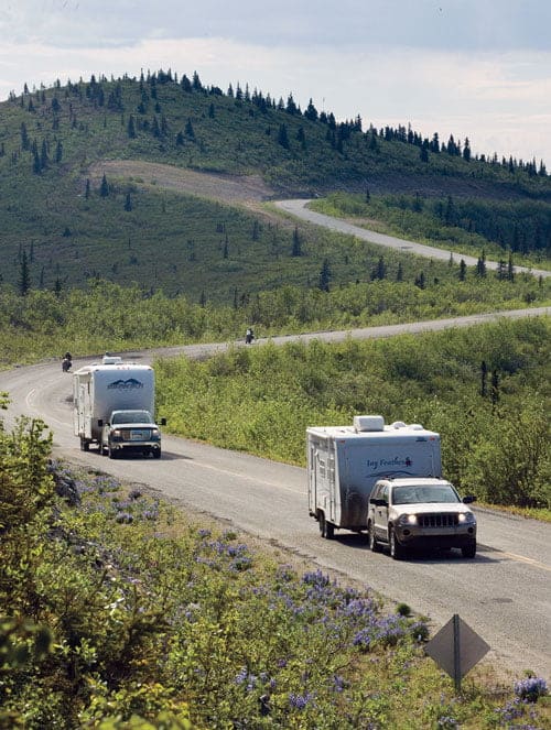
Dawson was on the cusp of becoming a ghost town if it didn’t turn to summer tourism. It all began with the restoration of the Palace Grand Theater and hasn’t slowed down since, thanks to the constant flow of seasonal money arriving via the Klondike Highway, the second most important road of The Magnificent 11.Next: Campbell Highway (#4) and Nahanni Range (#10)

